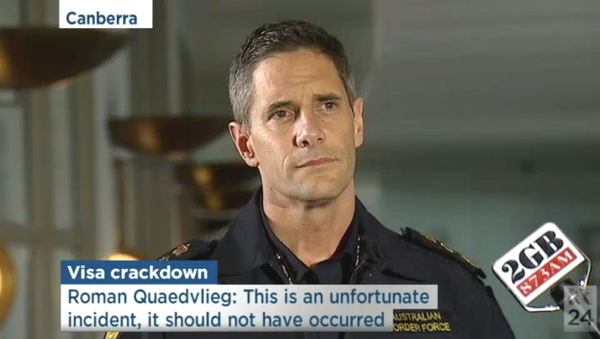
maps

You are currently browsing articles tagged maps.

Stilgherrian’s web links I’ve found for 02 July 2008, created automatically from internets.

Section of Tory Atlas of the World

I’m a sucker for maps. I’m especially a sucker for satirical maps of our psychopolitical geography. So I reckon this Tory Map of the World from 1982 is pretty special.

I particularly like the entire Indian sub-continent labelled as “Pakis” and the mis-identification of Singapore.

Bonus link: A map of The World according to Ronald Reagan, with Africa divided into “Egypt” and “Negroes”.

Thanks to Strange Maps for the pointer.

I’m a sucker for beautiful maps, so I simply must share this population density map of the US which I stumbled across today.

Population density map of the US

It’s part of a Time cover story from last year, An In-Depth View of America by the Numbers, which also includes What We Believe (31% of Americans believe in an “authoritarian God”, for example, while it seems only 6% don’t believe in God), Denomination Nation (exploring which kind of Christians live where) and Who We Are (which, being American, starts off by talking about race).

The NSW Electoral Commission has great interactive maps so you can find your local polling booth for 24 March. But they’re based on Google Maps. So as Richard Chirgwin points out, the mapping data is licensed in a very roundabout way.

Map of polling booths in Marrickville

The NSW Government street data is licensed to PSMA (the public sector mapping agency), which is then licensed to MapData Sciences, which is then licensed to Google Maps which is then licensed back to… the NSW Electoral Commission.

“We are surrounded by cretins,” Richard says. I tend to agree.

Though the defence is obviously that Google Maps provides a nice, convenient interface for programmers to use.

Using highly-classified Victorian-era satellite technology, Google Earth now includes views of the Earth from historical times.

Image from Google Earth 1844

Read the rest of this entry »

Who has controlled the Middle East over the course of history? Pretty much everyone. Egyptians, Turks, Jews, Romans, Arabs, Greeks, Persians, Europeans… the list goes on. This animated map shows the major themes — not perfect, perhaps, but at least the creators will listen to comments and update it.