Talking the Apple Maps disaster on Balls Radio

The disaster that is Apple Maps was the topic for my spot on Phil Dobbie’s Balls Radio this week.

If you haven’t caught up with Apple Maps yet, check the Tumblr of map disasters and listen to this week’s Patch Monday podcast. Short version: Apple decided to dump Google Maps from iOS 6 and introduce their own Apple Maps — but it’s a mess.

Here’s the audio of my segment. If you’d like more, Mr Dobbie has posted the full episode.

The program is no longer broadcast on FM99.3 Northside Radio, it’s purely a podcast. You can subscribe over at the website.

Links for 16 August 2008 through 20 August 2008

Stilgherrian’s links for 16 August 2008 through 20 August 2008, collected by a team of unemployed philatelists under a Word for the Dole program:

  • Actor’s Release Form | PakBuzz: I was looking for a sample release form which people could use to sign away their rights when they participate in my media projects. This one isn’t a bad start.
  • Video Capture and Editing in Linux using Kino | SLUG: Marghanita da Cruz’s notes from a year ago, explaining how to use a low-end (by today’s standards) laptop, free Kino software and consumer-grade video cameras to capture and edit video.
  • Is there anybody out there? | VatorNews: A 22-minute video interview with Twitter CEO Jack Dorsey, in which he explains the concept of “ambient social awareness”.
  • Cake Wrecks: As the subtitle explains, this is blog is about “when professional cakes go horribly, hilariously wrong”. Gentle amusement value.
  • Wirecast : Vara Software: “Wirecast is the most advanced live webcasting product available for your Mac or PC. You can stream multiple live video cameras, while dynamically mixing in other media (movies, images etc).” To be investigated soon, though the US$500 commercial license is putting me off a bit.
  • RAAF Bases | Google Maps: A map showing the bases operated by the Royal Australian Air Force (RAAF).
  • Mines of Papua New Guinea | Google Maps: A map showing the location of (presumably significant) mines in PNG.
  • AtGoogleTalks’ Channel | YouTube: Full recordings of the various @Google events, such as Authors@Google. More than 450 of them, including names like Noam Chomsky, George Lakoff, Salman Rushdie, Ralph Nader, Barack Obama…
  • Big Things of Australia | Google Maps: There’s more than 145 Big Things in Australia, from the original Big Banana in Coffs Harbour to… Well, this map shows them all. Explore!

Crikey: Oh no, Google took a photo of my house!

Crikey logo

[This article was first published in Crikey yesterday.]

This morning Australians woke to the news that Google’s Street View has taken photos of their street, their office, their school — their home! — and published them for all to see. Doubtless we’ll now see a flood of stories screeching “Invasion of privacy!” Hardly.

A picture taken on a public street isn’t “private”. A house is a visible, physical object that anyone can walk past and photograph. Its address is a known fact. Anyone can post pictures online with a description. Real estate agents do it all the time. All Google has done is photographed “everywhere” all at once, and given us the results.

Worried that knowledge of who lives in your house will become public? That data is already available — in the phone book, in most cases, or the electoral roll. If you’ve done any renovations recently, there’s probably even a floor plan of your house on your local council’s website.

Besides, when you use Street View, chances are the very first thing you’ll look up is your own home. Knowing this, Google can simply cross-match that with everything they already know about you: every Google search you’ve done, every link you’ve followed, every YouTube video you’ve watched — and, if a website uses the “free” Google Analytics or runs Google AdSense advertising, Google also knows about every such website you’ve ever visited. Congratulations, you just let them write your address across the top of their dossier!

And isn’t Google owned by the CIA anyway? Beware The Googling… ! [Insert maniacal laugh here.]

Continue reading “Crikey: Oh no, Google took a photo of my house!”

Polling booth maps clever, but whose map?

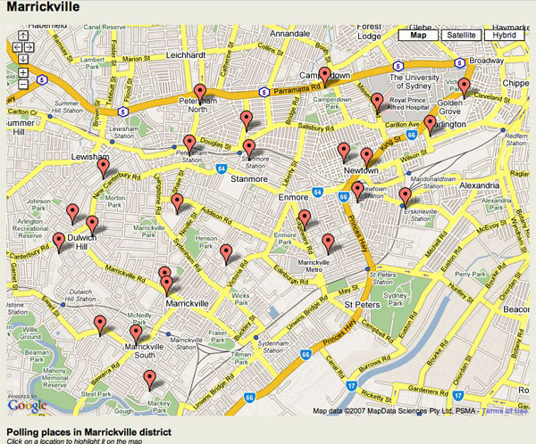
The NSW Electoral Commission has great interactive maps so you can find your local polling booth for 24 March. But they’re based on Google Maps. So as Richard Chirgwin points out, the mapping data is licensed in a very roundabout way.

Map of polling booths in Marrickville

The NSW Government street data is licensed to PSMA (the public sector mapping agency), which is then licensed to MapData Sciences, which is then licensed to Google Maps which is then licensed back to… the NSW Electoral Commission.

“We are surrounded by cretins,” Richard says. I tend to agree.

Though the defence is obviously that Google Maps provides a nice, convenient interface for programmers to use.

Look at the emergencies! Hear the Earth!

Two views of the Earth which help put things in perspective — AlertMap and Breathing Earth.

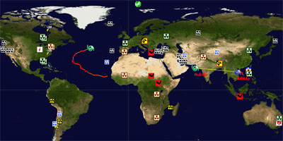
Alert Map

AlertMap (and the original Hungarian version) shows the emergencies and disasters happening on earth right now in real time — everything in the last 24 hours including biological hazards, epidemics, earthquakes, tropical storms, tornados, hail, aviation accidents, active volcanoes and more. Click on each icon for a detailed description and map.

Continue reading “Look at the emergencies! Hear the Earth!”